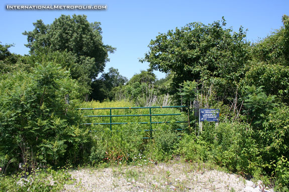
Today we jump in the car and head back to the county, in search of more lost Essex County. The map shows the town as being just south of the Michigan Central tracks in this map from 1959.

The MCRR tracks are long gone, but the remains of the rail line can still be seen.

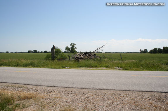
Across the street in a field, there appeared to be a pile of junk.

Upon further inspection it would seem that that’s where all the railroad ties ended up. 🙂

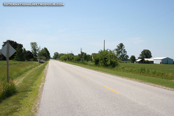
A view just south of the tracks towards Southwick reveals nothing more than a handful of houses.

Splitlog seems fascinating too.
I rally like this theme! Thanks for the pictures.
Jane, we also hit Splitlog, sadly there wasn’t even anything worth taking a photo of.
I’m glad you like it, there are a few more to go still.
I think this is a great theme too!
Apparently erca has plans for converting this rail right of way to another trail in 2-3 yrs. I imagine it would be much like the greenway.
Also with these ‘ghost towns’ located near the rail line, would there have been typically grain elevators, gas station, or country store nearby? although no physical evidence…
There is a CASO mailing list on Yahoo Groups where you can probably find alot of resources on stuff like that, Fausto. But in any case, it was common back then for small villages to set up next to the rail line – and just as common for said villages to disappear when the rail line is abandoned. That’s often how most ghost towns become ghost towns. If you guys are enjoying Andrew’s shots you might also enjoy mine at http://flickr.com/photos/tiz68/
I’m pretty sure this was the stretch of track my father used to pick wild berries alongside, before it became too overgrown.
I am relatively new to this site and I find it extremely fascinating. I am still going through some of the previous postings and I hope no-one minds if I comment on some of these.
One of the things I find fascinating is the site names scattered across the county. It makes you wonder how some of the names came into use.
I came across the name of Chief Splitlog in several books dealing with our local history. When I googled this name I was surprised to find a fairly comprehensive history (after he departed Essex County) on this individual. It is interesting from a historical perspective…
http://www.cayugamission.org/mathis.htm
I’m new to the site, so i’m aware that this thread is quite old! I live in old Anderdon Twp. and I know the spot well. Just in front of the tracks, (the north side), their was a family homestead. The house was torn down years ago I was told, though i’m not sure exactly when. I was also told that just to the east of the tracks, their was an old picnic grounds. I’d love to find out more about the area, but its pretty tough to find material on old Anderdon.
Chief Spitlog died in Essex County, it is said that he was wounded 7 times in various battles, in the Sandwich archives it shows a picture of a Splitlog as a fireman in the early 1900’s, dont know if any of the family is still around here,
It’s perhaps a bit of a stretch to refer to Southwick Station or Auld Station as ‘ghost towns’. Historically, there was a post office located at Auld (and likely at Southwick, too). I live just down the road from Auld and there is no evidence that it was anything more than a rural stop along the rail line for postal purposes and maybe for the loading or unloading of local goods — nothing to suggest that it was ‘developed’ in any way that would accord it ‘town’ status.
This summer I purchased a fascinating and comprehensive (400+ pages) history book of Anderdon Township entitled “Anderdon: Some Folks Down the Road” c.2012, authored by former resident Mark Warren. I recommend this to anyone interested in this former township’s history. Auld, Southwick, Splitlog and Lukerville all receive attention in this recently published book.
As a child growing up in McGregor, my friends and I would place coins on these tracks at the predicatable train crossing time (the boys would use rocks from the rail beds, ugh!)and would happily wave at the engineer before gathering up the flattened end products.
Thanks for the info on this new book, Vicki. I’ll look for it. Where did you get your copy?
From a historical perspective, it is also worth noting that the partially obscured homestead pictured on the right side in the lowermost photo was the Whelan residence (purchased by the father of Sen. Eugene Whelan from of the granddaughter of the original owner by the name of McQuaid). Since the time of the original posting of this thread in ’07, the homestead has been demolished. Happily, the original McQuaid log cabin, around which the home was expanded for the growing Whelan family, was preserved and moved to the Canadian Transportation Museum and Heritage Village. It can be seen there today while awaiting funding for its final proper restoration.
John, I purchased mine at the Gordon House in Amherstburg, though I am pretty certain you could also obtain a copy at the Marsh Collection Society office on Dalhousie Street in A’burg across from the former Amherstburg Echo office. As I recall, it was around $50 and well worth every cent of it (1877 pull-out Walling Map included!). The author also maintains a website devoted to this publication. One might think of this former township’s history as being essentially dull until they discover how colourful it truly was via this book.
I emailed the author and got some purchase options info. Will pick up a copy next time I roll through the A’Burg area (which is often enough). The previews look amazing. Worth it for the big map alone.
A few years ago I noticed that chief splitlog’s grave and headstone are at the foot of the detroit river just outside of amherstburg where the golf course is I cannot remember the name of the golf course at this time though. The grave stone is a cement tree stump with his name on it . The white family is dispersed throughout essex county.
Probablt the Wyndotte Indian Cemetary you were looking in, Larry.
Is this it?
http://goo.gl/maps/HBYbd